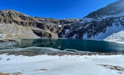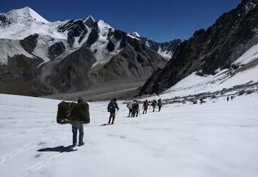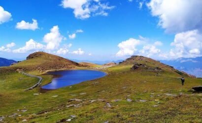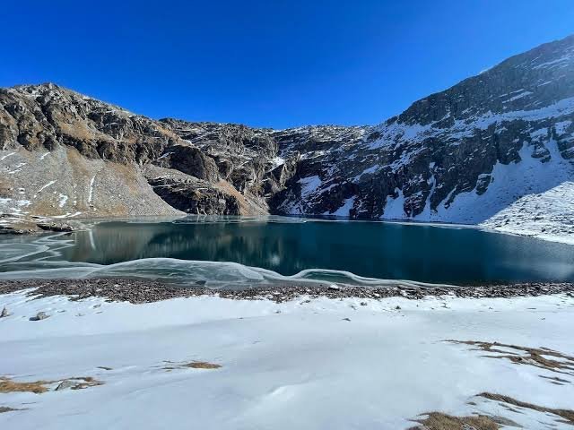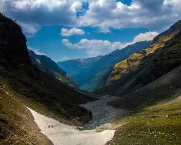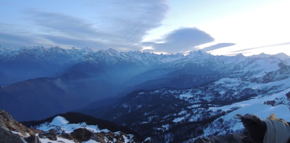
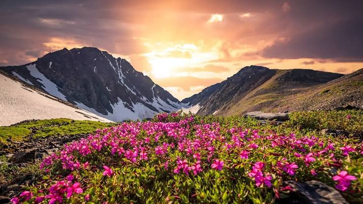
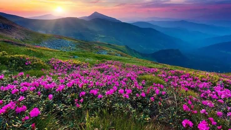
Valley of Flowers National Park is an Indian national park, located in North Chamoli, in the state of Uttarakhand, and is known for its meadows of endemic alpine flowers and the variety of flora. This richly diverse area is also home to rare and endangered animals, including the Asiatic black bear, snow leopard, musk deer, brown bear, red fox, and blue sheep. Birds found in the park include the Himalayan monal pheasant and other high-altitude birds.
Overview
The Valley of Flowers Trek is one of the most beautiful and peaceful Himalayan journeys in Uttarakhand. Famous for its colorful alpine flowers, waterfalls, misty mountains, and scenic landscapes, this UNESCO World Heritage Site offers a magical trekking experience in the lap of nature.
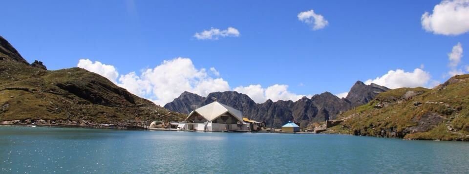
This trek also includes a visit to the sacred Hemkund Sahib, one of the highest Gurudwaras in the world surrounded by snow-covered peaks and a glacial lake.
Itinerary
Basic details for the day: This trek covers the distance between Kirti Nagar and Pipalkoti between 213 kilometers to 248 kilometers in 8 to 10 hours. The trek begins at an elevation of 1,200 ft to 4,400 ft at Pipalkoti / Joshimath during this leg of the trek. The increase in altitude of 3,200 ft provides controlled ascent to initiate acclimatisation by allowing your body to start adjusting to changes in pressure and oxygen while still being transported in a vehicle.
Route Description and Terrain Insights: You will be driving on National Highway 7 (NH7), which is the main road for religious devotees Badrinath. The terrain of this part of NH09 consists of ghat roads that have been cut along the mountain sides. Each ghat road has steep cliffs on one side and steep cliffs on the opposite side leading to deep gorges. The mixture of paved roads and dirt roads will be influenced by recent weather events. During the rainy season, many roads are muddy or gravel, creating the potential for accidents. In addition, you will be negotiating hundreds of hairpin turns, which will create the need for you to maintain your balance.
Drive Distance - 213 / 248 Km (9 - 10 hrs)
Altitude Gain - 3,200 ft.
Meal - Snacks & dinner
Stay - At Pipalkoti hotel
Basic details for the day: The journey for the day is broken down into two segments: 40 kilometers of driving and 9 kilometers of trekking. When you finish today's drive, you will have ascended 5,400 feet in elevation, which is a significant amount to put on your lungs in one day. Ghangaria is located at an elevation of 9,800 feet just below the tree line where there isn't as much air to breathe in.
Route Description and Terrain Insights: To get to Govindghat, you drive through the narrow Alaknanda Valley in the morning, go to Joshimath, and finally arrive at the meeting point of the Alaknanda River and the Lakshman Ganga River. After you get to Govindghat, a taxi will take you a short distance to Pulna, where your trek will begin. The path to Pulna is predominantly well built and paved with stones, as you ascend the hills. Most of the way up to Ghangaria is extremely steep and zig-zagged. The trail is winding and surrounded by oak, pine, and rhododendron trees with the cheery and loud Lakshman Ganga River flowing parallel to the trail.
Drive Distance - 52 Km (3 hrs)
Trek Distance - 9 Km (5 hrs)
Altitude Gain - 5,400 ft.
Meal - Breakfast, lunch, snacks & dinner
Stay - At the Ghangaria guesthouse
Basic details for the day: Your third day is a round trek of 6 - 7 km that is expected to take around 7 hours with an elevation gain of 1,700 ft, which will bring you to a total elevation of 11,500 ft. when you head back to Ghangaria. The trek is rated as easy to moderate in difficulty; all food items included in the trek (breakfast, a packed lunch for the valley, and dinner) will be provided. You will spend the night again at the guesthouse in Ghangaria which allows you to only have a light daypack to carry throughout the day.
Trail Description and Terrain Insights: After the forest checkpoint, you cross a large iron suspension bridge over the Pushpavati River. This trail has a width of about 4-6 feet with loose soil and rocks as well as small stream crossings. As there are no mules or helicopter access on this trail, compared to Hemkund, it is very clean air with no noise compared to the other trail. The first 3 km requires a zig-zag ascent through a very dense cover of Silver Birch (Bhojpatra) trees, followed by Fir trees until you finally arrive in the very wide U-shaped glacial valley.
Trek Distance - 6 - 7 Km (7 hrs)
Altitude Gain - 1,700 ft.
Meal - Breakfast, packed lunch, snacks & dinner
Stay - At Ghangaria guesthouse
Basic details for the day: The most challenging day of the overall trek is today. We will be making a very steep 5.5 km ascent which will take about 7 hours to reach our destination and gain an astonishing 4,300 ft of vertical gain in elevation (the Gurudwara located at altitude of 14,100 ft). We will then have to make the descent back down to Ghangaria. The trek is classified as difficult due to both the steep grade and diminished availability of oxygen. We will have breakfast at the guesthouse, enjoy a traditional Punjabi meal (Langar) at the Gurudwara and then return to the guesthouse at Ghangaria for evening snacks and dinner.
Trail Description and Terrain Insights: The trail leading to Hemkund is well-maintained; however, it is very steep as it is made entirely of stone and is paved with large stone blocks. This trail is also used by mules and palanquins so many people will be passing each other during your ascent. The trail has many switchbacks and uphill extremely steeply through the sub-alpine forest and eventually becomes rocky and arid in the high altitude zone. The last leg of the ascent is known for its 1,100 stone hand-cut stairs to the holy lake.
Trek Distance - 5.5 Km (7 hrs)
Altitude Gain - 4,300 ft.
Meal - Breakfast, lunch at Gurudwara, snacks & dinner
Stay at the Ghangaria guesthouse
Basic details for the day: Today is your fifth day of trekking, marking your return journey back home. You will begin the journey by descending 13 km over approximately 5 hours, and you’ll drop 5,400 feet from Ghangaria (9,800 feet) to Govindghat (6,800 feet), and then you’ll be driven from Govindghat to your destination, Pipalkoti or Joshimath. Even though it is a moderate hike based on elevation, gravity helps move you down the trail at a quicker pace than if it were flat; however, the fast pace will still tax the knees. Your day will begin with a hot breakfast at Ghangaria, you’ll have a packed lunch with you on your way, and you’ll finish the day with evening snacks and a warm dinner at your hotel in Pipalkoti / Joshimath.
Trail Description and Terrain Insights: The route is the same as the way you ascended on Day 2 with the only difference being the direction (downstream). The trail and terrain are very much the same as you’ll be following the Lakshman Ganga River all the way down the mountain. During your descent there will be several iron bridges that will require you to cross while continuing down the trail. The terrain will consist of both steep and gradual declines that you’ll be using to travel down the mountain, along with other mules and pedestrians (Yatras). Therefore, while the path is marked throughout this area, the continuous downhill slope can be very hard on your legs; watch your step and try to avoid the "elephant skin" stone which could be very slick if wet.
Trek Distance - 9 Km (5 hrs)
Drive Distance - 52 Km (3 hrs)
Altitude Loss - 5,400 ft.
Meal - Breakfast, packed lunch, snacks & dinner
Stay - At Pipalkoti hotel
Basic details for the day: Your trek journey ends in Rishikesh at the foothills of the Himalayas. The last leg of the journey from Pipalkoti / Joshimath to Rishikesh is 213 km / 248 Km long and will take at least 9 -10 hours to drive depending on weather and road conditions. You can expect to lose about 3,200 feet in elevation; thus, you will go from the cool mountain air at 4,400 feet to the tropical climate of Rishikesh at 1,200 feet. Your trekking package usually contains tea or coffee at the hotel, while lunch and other meals during transit are your personal expense at restaurants / roadside stands.
Route Description and Terrain Insights: Driving along Badrinath - Rishikesh National Highway, a feat of engineering in the mountains that follow the Alaknanda River and later the Ganga River. The road consists of winding ghat roads with numerous steep inclines and hairpin turns. The steep and narrow gorges of the upper Himalayas you descend into broaden until you reach the wide valleys on the Shivalik mountains. You will pass through several significant villages (towns) en route including Chamoli, Nandprayag and Srinagar.
Drive Distance - 213 / 248 Km (9 - 10 hrs)
Altitude Loss - 3,200 ft.
Meal - Morning tea/coffee only
Includes/Excludes
Cost Includes
- 1 - Pre-Trek Support by Experienced Trek Coordinators
- This is a special component of Touch Himalayas, where a personalized trek coordinator is assigned to each trekker and who makes your preparation easy before coming on a trek, all your doubts, queries, and myths are clarified, and you are mentally and physically guided to ensure that you come fully fit for your adventure. Every aspect, from what to carry to what exercises need to be done and how to prepare yourself for the trek, all will be guided by Touch Himalayas's Experienced Trek Coordinators.
- 2 - What is included during the trek
- The offered cost covers all major essentials that are mandatory for a successful adventure, such as accomodation, meal, permit, team of experts, trek equipment, safety gear, and mule / porter support. We provide you all the services that are involved in the trek. Below find specifics.
- Accommodation: 2 Nights stay in a designated hotel by Touch Himalayas at Pipalkoti on sharing basis & 3 nights' accommodation at Ghangaria in a guesthouse on a sharing basis.
- Meal: Your meals with Touch Himalayas start with evening tea & snacks on day 01 in Pipalkoti / Joshimath and end with tea / coffee on Day 06 in Pipalkoti / Joshimath. All meals provided by Touch Himalayas involve pure vegetarian and nutritious meals. We offer you breakfast, lunch, tea, snacks, and dinners. The meals are freshly cooked and non-repeated with delicious sweet dishes each night.
- Food Preferences for Jains: A large percentage of our trekkers belong to the Jain community, we understand their concern very well. When we have Jain trekkers on our treks, we will create special, custom-made meals without garlic and onion. We cook these separately from other foods prepared by us, maintaining the same great quality, taste, and hygiene.
- Special Occasions Celebration: Whether it is a birthday, anniversary, group summit, or another event, we enjoy celebrating all these occasions with you by presenting you with a cake that is freshly prepared for your special moment. Touching Himalayas will ensure that every special moment you have here is never forgotten; in fact, it will become an extra special moment.
- Permit: All camping and Trekking Permits from Forest Department, full assistance in documentation and formalities will be given by the Touch Himalayas team.
- Team of Experts & Professionals:
- Trek Leaders: Qualified and Experienced Trek Leaders to lead your group when on Trek. Touch Himalayas Trek Leaders are AMC, BMC certified and trained for immediate First Aid with a search & rescue Course.
- Assistant Trek Leaders: They are supervised under the Trek Leader's guidance focussing on the safety, logistics, and trekkers' engagement.
- Local Guides: Experienced local guide familiar with region & routes. They understand the way of conduct better, especially being locals.
- Support Staff: A team of high altitude including mountain chefs and Helpers to prepare and provide you healthy and freshly cooked meals on your trek.
- Safety Gears: Touch Himaylas stands proud itself that all our Treks and adventures operated since 1993 are without any single casualty as we take safety of our trekkers and staff on high priority, following are some of the gears that are included in your trek cost.
- Oxygen Cylinders
- First Aid and Medicine
- Stretchers
- BP Machine to regulate your blood pressure
- Oximeters to regulate your oxygen flow
- Health cards to measure your daily BP and Oxygen reading
- Walkies Talkies for Immediate communication
- Micro Spikes
- Gaiters
- Other Safety Equipment such as Helmets, Rops, Ice Axe, Carabiners much more as per technicality of a Trek.
- Porters / Mules Support: Porters / Mules are provided to carry your common trekking gear, rations, trekking equipment and other supplies.
- 3 - Post-trek Assistance
- This section implies with the following:
- Trek Feedback and improvement advice call from your Trek Coordinators.
- How to overcome Trek injuries and settle to normal life.
- Advice and suggestions for Next Adventure Trek.
- Completion Certificate:
- It is the best way to recognize someone’s adventure journey with a certificate. A well recognized certificate (IMF, ATOAI & Uttarakhand tourism development board) approved is provided to the trekker by two ways:
- Reached at Summit: we are giving certificates of summiteer to those trekkers who have completed their trek at the Summit.
- Incomplete Summit: we also provide our certificate for those who have not reached the final summit due to medical reasons but they are part of the trek.
Cost Excludes
- Travel to/from Pickup Point: Arrival at the pickup point & from the dropping point at Natraj Chowk, Rishikesh is exclusively your call, you can book a bus, train or flight one day prior & after your trek starts or ends.
- Meals & Accommodation: Any meals or accommodations that are not mentioned in the inclusion that completely manage at your own cost.
- Transport Cost: We provide you with the transport facility from Rishikesh to Pipalkoti, Govindghat to Pulna and return back to Rishikesh (both ways), along with a visit to Badrinath at the cost of ₹ 2,500 per person. If you arrive with your own vehicle at Joshimath, you only need to pay ₹ 1,000 from Joshimath to Govindghat.
- Personal Services: Other personal services like laundry, phone calls, charging batteries, beverages, bottled / mineral water, or some other services are completely at your own cost.
- Medical Expenses: Any personal medication for your cause is at your own risk. Trekkers are encouraged to bring all your prescribed medicine and any personal first-aid supplies to avoid any uncertainty at the trek.
- Personal Trekking Gears: If you need any extra essentials, you can rent these items like Rain Poncho, Trekking pole, Head Torch, Crampons, Shoes gaiters, etc. For renting these gears, you can contact us at +91-9286429119. Note: Book your trekking gear 10 days before your trek.
- Backpack Offloading: It is a totally optional service. If you have luggage & you want to carry for the whole trek. So you can book before your trek starts. Offload Charges: ₹1600 per bag for the entire trek if paid online in advance & if you book on the spot, an additional 30% extra cost will be applied.
- Tips for Crew: Tipping is a personal gesture of appreciation to the team’s hard work. If you really like the crew team for their behaviour, kind & welcoming attitude towards the trekkers. So it's up to you how you appreciate them with some cash or gift. It's exclusively your wish.
- Our transportation add on includes travel from Rishikesh to Pipalkoti, Govindghat to Pulna (both ways), along with a visit to Badrinath.
Frequently Asked Questions
General
The Valley of Flowers is located in the Chamoli district of Uttarakhand, within the Nanda Devi Biosphere Reserve. It is a UNESCO World Heritage Site known for its rich biodiversity and stunning alpine landscapes.
The trek is considered easy to moderate, making it suitable for beginners, families, and experienced trekkers alike.
The Valley of Flowers is situated at an altitude of approximately 3,658 meters (12,000 feet) above sea level.
The best time to visit is from July to September, when the valley is in full bloom with hundreds of species of colorful wildflowers.
A typical Valley of Flowers trek takes 5 to 6 days, including travel from Rishikesh, Haridwar, or Dehradun.
Yes, the trek is one of the best Himalayan treks for beginners due to its well-defined trails and moderate difficulty level.
The trek covers approximately 38–40 kilometers, including the trek to Hemkund Sahib.
The valley is famous for:
- Over 500 species of alpine flowers
- Stunning mountain scenery
- Rare Himalayan flora and fauna
- UNESCO World Heritage status
- Beautiful waterfalls and streams
Yes, most itineraries include a visit to Hemkund Sahib, one of the highest Gurudwaras in the world located at 4,329 meters.
The trek begins from Govindghat, which is accessible by road from Rishikesh, Haridwar, and Dehradun.
Yes, all trekkers must obtain an entry permit to enter the Valley of Flowers National Park.
Accommodation is available in:
- Hotels and guesthouses in Joshimath
- Guesthouses and lodges in Ghangaria
- Homestays and budget accommodations along the route
Average temperatures are:
- Daytime: 10°C to 20°C
- Nighttime: 3°C to 10°C
Weather can change quickly in the mountains.